Within EPOC, our guiding approach is to assess the mechanisms and processes of the AMOC, as a function of timescale and latitude/region, using high-resolution coupled models capable of better representing fine-scale ocean features and air-sea coupling, and exploiting comprehensive AMOC-related observational datasets to be generated. We focus on the geographic region from 35°S to the Arctic, considering the Arctic to be the ultimate headwaters of the AMOC and the latitude of 35°S as an open boundary to the Southern Ocean. Our temporal focus is on AMOC variability on human timescales (one year to one century, spanning 1850-2100), while for AMOC impacts we concentrate on decadal to multi-decadal fluctuations in the AMOC, based on the expectation that AMOC changes on these timescales generate more sustained climate impacts with greater societal relevance than shorter-timescale, reversible AMOC fluctuations. Impacts assessed will include much shorter duration extreme weather events, including, for example, changes in their frequency or intensity.
EPOC will re-evaluate ocean transport variability to explicitly address the question of how conveyor-like the great ocean conveyor really is, identifying processes responsible for maintaining or breaking connectivity, and the timescales at which the AMOC ‘switches’ from a set of local processes to a more conveyor-like phenomenon. This fundamental recasting of the AMOC – departing from a conveyor-like expectation and a single value for its strength – will transform current understanding of AMOC variability and its function in the Earth system, and lay the foundation for a more fit-for-purpose, effective and sustainable AMOC observing system.
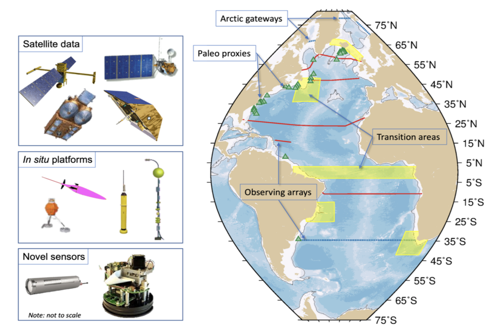
EPOC’s approach is designed to capture the AMOC as a whole system, 35°S to the Arctic, and will use novel observational approaches with multiple constraints from a range of sources to generate new understanding of the AMOC. Yellow regions highlight “transition areas” where local processes may change meridional coherence, green triangles show proxy core locations (a subset is shown for clarity), red lines show observing array data, and blue dashed lines show arrays at the northern and southern boundaries of the region.